
Mediterranean Landscape Hike near Cinque Terre
 |
| Portesone, an abandoned village near Lerici on the Gulf of the Poets. |
This hike is moderately easy and will take about 2 1/2 hours, although it can be shortened at several junctures along the way, since you can climb to the peninsula road that parallels the trail. There are only a few steep parts, and no cliffs, and we think it would be safe for children accustomed to hiking. There are no water sources en route, and only a basic food store at Serra . The trails are rather rocky, so shoes with good soles are recommended. It can be reached by car or by public bus from Lerici, or by an uphill walk from Lerici and/or Tellaro.
Note: In Spring, 2016, there was a major cutting of vegetation around Barbazzano. We have seen photos and the area is more visible than locals can ever remember. Be sure to take the described side trip.
 |
| Tellaro in a rare light fog as seen from the trail. |
Travel Tip_____________________________________________________________________
Renting A Car in Italy. If you drive in urban areas at home, you can drive in Italy. Car rental prices are important, but don't rent based solely on low price and stick to well known companies. We have two articles to help you: Link: Independent Car Rental Reviews for Italy
Link:Car Rental Tips for Italy - Pick It Up Right
We advise getting your car from one of the companies with the fewest problems reported (Avis, Europcar, Hertz, Autovia, Budget) either direct or via a reputable car rental broker such as AutoEurope (NOT autoeuropa, ending in 'a'). The advantages of using AutoEurope are the added services without paying more - low price guarantee; 24/7 help before, during, and after the rental; easy changes and cancellation; as well as available less expensive zero excess (deductible) insurance.** If you find our efforts helpful, you can thank us by making your reservation through these links -using the links do not raise your price.
AutoEurope(US) Auto Europe(UK) Avis(English) Avis(IT) Budget Rent A Car (English)
_________________________________________________________________________________
 |
| The trail is well marked by CAI volunteers. |
Begin the hike by walking downhill and westward on CAI 3 toward Tellaro and La Serra. The trail is gentle and provides glimpses of the far-off Portovenere peninsula and the Gulf, as well as peeks into the activities of nearby homeowners. The plant life is wonderfully Mediterranean, and lucky is the hiker who has studied botany. Here and there the trail preserves the ancient paving (also known as stones) that kept the roadway from turning to total mud in wet weather. These paths are the original means of travel between the villages of the promontory, and are thus at least 1100 years old!
 |
| Hairpin turns with ancient pavement. Zanego to La Serra trail. |
Walk and look and walk some more, generally downhill. The views here are excellent as there's quite a bit of open area. After about 20 minutes, the Trail CAI 3h and then CAI 466 branch off left down to Tellaro, but you'll continue on the main CAI 3 for almost the entire hike. On two occasions, you'll walk past evidence of enormous rockfalls. Gigantic boulders sit above and below the trail, stupendous reminders that, in creating this wonderful landscape, the earth doesn't sweat the small stuff.
 |
| The village of Portesone abandoned after the Plague. |
When you resume the hike, pay attention to the terraces. Though they are now overgrown in many places, in centuries past almost all the land was utilized, and the views would have been panoramic. These flat patches of land, bolstered by rock walls, were necessary to increase the agricultural production of the land by optimizing water use and soil area while minimizing rocky areas. The important crops for these villages were figs, olives, vines, grains, and vegetables. Pasturage was also important for the production of cheese and the raising of sheep, as well as chickens and pigs. The enormous amount of earth moved to create the terraces, shovelful by shovelful, rock by rock, was done by individuals seeking economic gain, but under much different circumstances than ours. This land was owned by the Bishop/Count of Luni, and was worked under terms that required the peasant to make payments in money, produce, and/or labor.
 |
| Olive trees can live well over 2,000 years. Caprione Promontory. |
Olives remained a mainstay of the economy in this area into the 1950's. In the centuries before roads were viable, this area's sea access was a valuable competitive advantage, and these sunny slopes are ideal for olives as well as figs and vines. Olive trees can live for thousands of years, so it's perfectly possible that the large gnarly olive tree that is now watching you pass, also watched Signor Carlo Bonaventura and his son Salvuccio of Barbazzone walking to that meeting in Zanego in 1328.
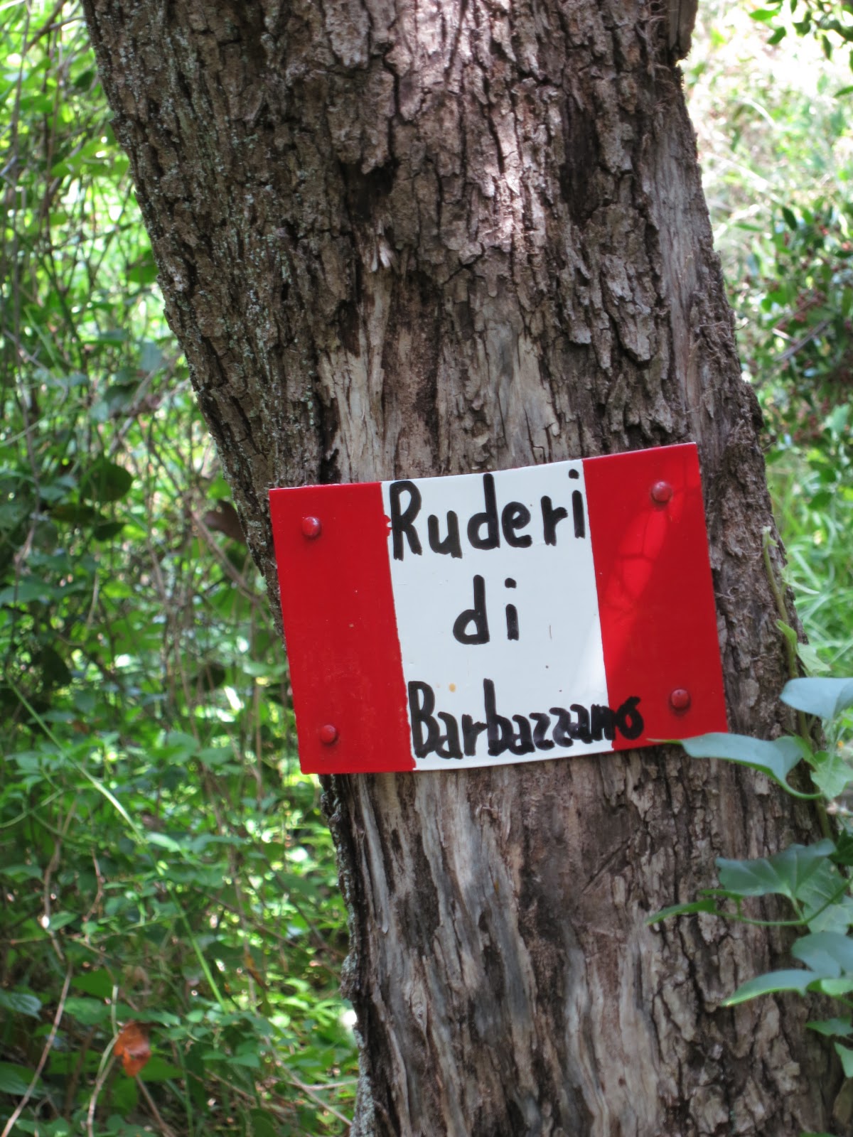 |
| Ruins of Barbazzone. |
 |
| Former Church of San Giorgio in abandoned Barbazzone. |
Although it is commonly said that the village was abandoned after attacks by Saracens in the 15th century, the truth is more nuanced. The village was indeed attacked between 1562 and 1564, but it was depopulation that slowly vanquished the town, and Tellaro gradually took its place. The town parish was transferred to Tellaro in 1570.
To continue, walk back up to Trail 3 from Barbazzano, and turn to the left. (near the ruins is the Trail 464 which goes from Barbazzano to La Serra more directly but we haven't walked it so we are reluctant to recommend it). The trail repeats the themes: terraces, olives, abandonment, renewal. There's invasive bamboo, deliberately introduced acacia and aguave. As you approach La Serra, there are a few homesteaders that have narrowed the trail with fences, but the beauty of the land is not reduced. Finally, near the gated entrance to a villa, Trail 3 crosses a concrete driveway/road. Here you turn right on Trail 469, and climb up the steep driveway to the peninsula's perimeter road.
 |
| Campanile in La Serra, Liguria. |
Copyright 2012 www.apathtolunch.com. All Rights Reserved. This article appeared on www.apathtolunch.com and has not been authorized elsewhere.
The return to the starting point at Zanego is along the asphalt road. It is generally uphill, but it will only take a little more than 1/2 hour, and the views of the Gulf will encourage you. Most days there is little traffic, but take care for the bicycles can approach quietly.
More Info
Recommended CAI Map Bassa Val di Magra / Parco di Montemarcello-Magra 1:25,000 Carta Escursionistica. 4LandAlpine Cartography 6.50 Euro. Sold in area bookstores and news stands.
There's also a CAI Sarzana map online - CAI Sarzana Trail Map
Club Alpino Italiano (CAI) Sarzana Thanks to CAI volunteers for these trails. The CAI office in Sarzana at Piazza Firmafede, 13 is open Monday to Saturday from 5 to 7pm and has a good selection of maps.
Parco Montemarcello and Parco di Montemarcello-Magra The Parco Montemarcello-Magra has more interesting hiking trails, but it doesn't promote them well. Some information is available on these websites and sometimes at an office in Montemarcello, near the two bars on the Gulf side of town.
Our story The Brides Walk from Ameglia to Tellaro, also passing through Zanego, is similar to this hike, but with more vertical displacement.
Caprione Promontory Our Google map with towns and points of interest as well as our notes on restaurants and miscellany.
Sources
Ameglia Nella Storia Della Lunigiana by Ennio Silvestri, the esteemed mayor, neighbor and historian we wish we had the pleasure to meet.
Cavanei-Barbazzano-Storie-e-Notizie-del-Monte-Caprione-di-Lerici A fascinating Facebook page by a fellow history lover.
Guide Al Parco di Montemarcello by Simonetta Maccioni Sagep Editrice 1991.
Written by Martha